Some hiking trails reward your efforts with access to an occasional viewpoint, or maybe a photo-worthy destination at the end of the hike. But Glacier’s Highline-Loop Trail is much different. From start to finish, it’s a non-stop jaw-drop. You’ll always have an amazing view in front of you, behind you, and on at least one side of you. It’s no wonder that the Highline-Loop Trail often lands at the top of “best hike” lists. Sure, it’s a popular, crowded trail, and the entire hike requires a long day. But the Highline-Loop Trail is simply spectacular.
Location
Glacier’s Highline Trail begins at Logan Pass, along Going-to-the-Sun Highway. You can park at the Visitor’s Center at the pass (if you’re able to find a parking spot). If you’re hiking the Highline-Loop Trail combo, your hike will end at The Loop parking area, which is about 8 miles west of Logan Pass. If you can’t find parking at Logan Pass, you can attempt to park at The Loop, then take a park shuttle bus to the pass. There are other transportation solutions as well – I’ve outlined them on a separate page.
My Visit
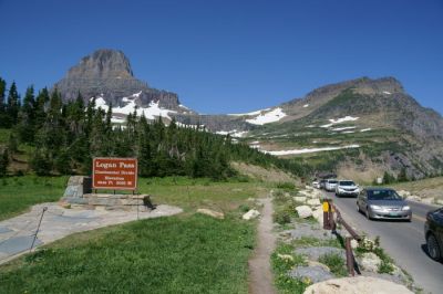
After a couple of frustrating hours spent in traffic, hunting for a parking spot and then waiting for a shuttle, I finally made it to the start of this epic trail. The hike begins at Logan Pass, the high point of Going-to-the-Sun Road — a highway that’s just as stunning as the trail, largely because the two paths follow a similar route for at least part of the way.
Highline-Loop Trail
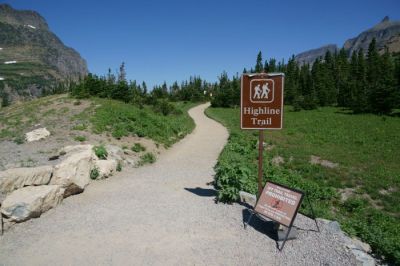
Dodge traffic as you cross Going-to-the-Sun Road, and you’ll find the trailhead for the Highline Trail on the opposite side. I decided to hike the Highline-Loop Trail route, but you could also choose to hike out-and-back on the Highline Trail. You could go all the way to Granite Park Chalet before returning, or choose another turnaround spot. There are several good destinations; I’ll point them out below.
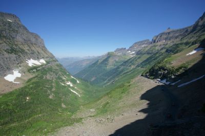
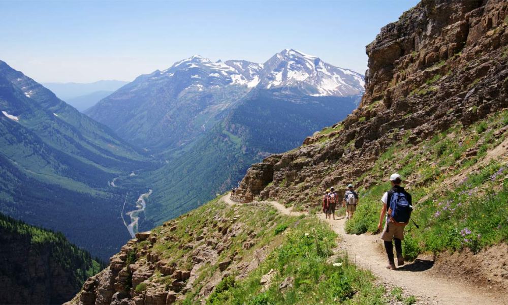
As promised, the view is almost instantly amazing. At this point, the trail heads almost due north, giving you a beautiful view up the valley. Going-to-the-Sun Road follows the same route, although the road is down the side of the cliff, and you’ll soon forget that it’s there.
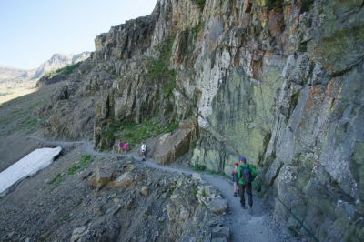
The first half-mile of the Highline Trail is quite dramatic. The trail is cut into the face of the rock wall, creating a shelf that some might consider frighteningly narrow. There are chains attached to the wall, which you can use if you’re nervous. But the truth is, hikers can easily pass one another, without much risk.
If you only have an hour (or less) to hike at Logan Pass, this narrow section of the trail makes a good turnaround point.
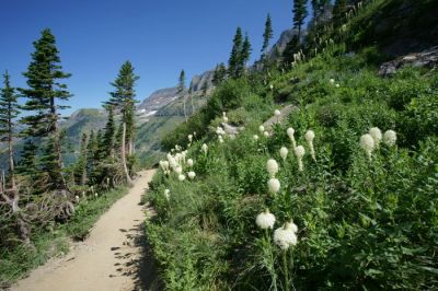
Get used to walking on the side of the cliff — not a lot changes for the next few miles. The Highline Trail will keep you perched on the mountainside for most of the day, but it feels much more secure in some places, like this one, where some trees have taken root. You’ll also notice those Q-tip looking flowers in bloom. That’s called Bear Grass, and during the month of July, you’ll see plenty of it at Logan Pass and along the Highline Trail.
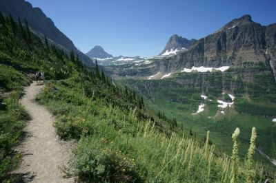
With such a great view looking forward, it’s easy to forget to turn around. When you do, you’ll enjoy a nice view looking back towards Logan Pass and the trailhead.
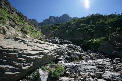
Sometimes it’s a good idea to look straight up the hillside. In this spot, snow-melt tumbles downhill, crossing the trail, and then Going-to-the-Sun Road, further downhill. I think this spot is directly above the Triple Arches, and the road’s famed “widowmaker” curves — which flattened a tire on my shuttle bus, earlier in the day.

Anytime you see an outcropping of loose rock, odds are good that you’ll see one of these little guys — a marmot. Not to be judgmental, but this one is probably a hoary marmot.
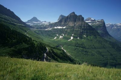
Logan Pass is getting further away…
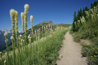
… as you approach another vast field of bear grass — some of which is shoulder-high.
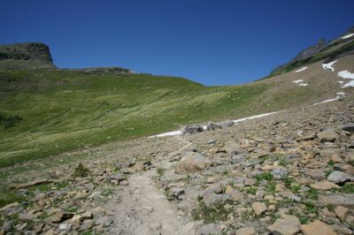
About halfway to Granite Park Chalet (or a little less than four miles from Logan Pass), you’ll reach another very good stopping point. Here, you’ll pass a large field of rocks, then zig-zag up the hillside, circling around Haystack Butte – the big hill you see on the left. The rocks (including one very big boulder) give you some good places to sit and enjoy a snack. And, if you’re using this as a turnaround point, you can also avoid that steep climb up to the saddle.
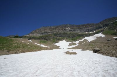
If you decide to soldier on, you’ll probably encounter some snow, no matter what time of year it is. As of late July, this very big snowfield was still sticking around. It’s really just an icy slush at this point, which makes snowball fights especially painful.
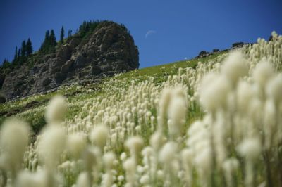
On the way up to Haystack Butte, the brilliant display of bear grass continued. I was also in the right spot at the right time to catch a crescent moon dropping below the hill.
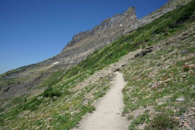
Once you’ve crested the saddle, the trail heads down the other side. But the truth is, aside from that one steep climb, the Highline Trail stays surprisingly level for its entire length. And that’s a very good thing, considering you might be attempting a 15+ mile hike, all in one day, if you hope to hike out-and-back from Logan Pass to Granite Park Chalet.
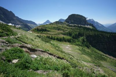
A short distance further, you can get a great view of Haystack Butte behind you. That ever-diminishing view of Logan Pass is now a memory.
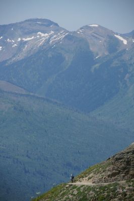
The next few miles of the trail seem even more wide-open than before. You’ll have a great view of the trail ahead, and the mountains in the distance…
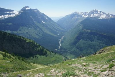
… as well as the valley to the southwest. Somewhere down there is Going-to-the-Sun Road, as it approaches Lake McDonald and the West Glacier park exit.
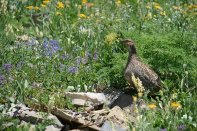
Is this a pheasant? A grouse? Perhaps a Ptarmigan? This guy was simply chilling out, next to the trail, unfazed by any of the hikers trudging by.
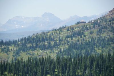
If you’re ready for a break, there’s another good stopping point, just as Granite Park Chalet comes into view. This is an exciting moment, now that you can see your destination! But, it’s still probably two miles away, give or take.
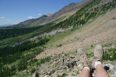
Rest your feet on the rock outcropping for a moment, then start hiking again!
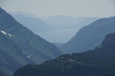
With a mile to go before the Chalet, you’ll notice an excellent view of Lake McDonald unfolding to your left. The lake is visible amid multiple layers of mountains. It was somewhat hazy during my hike, but this view might look even better, earlier in the day, in less-smoky air. (During my visit, smoke was drifting in from wildfires in British Columbia).
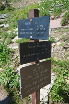
With about 8/10 of a mile to go to Granite Park Chalet, you have to make a big decision. Do you have the time, and the energy, for a side-trip?
The sign suggests it’s just 6/10 of a mile up the Garden Wall Trail to Glacier Overlook. But…
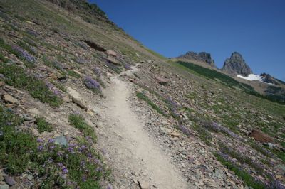
… the key word in that last sentence is “up”. This is a very steep trail — you’re basically climbing a staircase up to the viewpoint. And, I’m pretty sure 6/10 of a mile is an understatement. I’ll talk more about it, and what you’ll see if you decide to hike it, on a separate page.
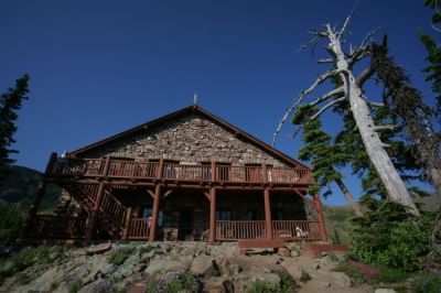
Because I decided to hike all the way up to Glacier Overlook, I was pretty exhausted when I finally reached Granite Park Chalet. I headed inside…
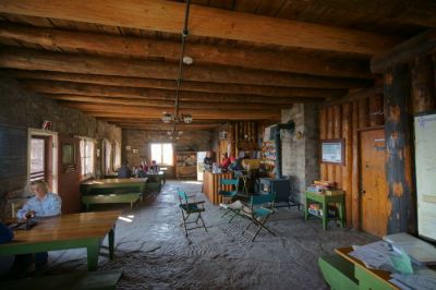
… and plopped down at a table. The Chalet sells a handful of snacks and sandwiches, but they aren’t cheap. Water and Gatorade are also sold here, but they are also very pricey. If you need water, you can get it from a stream nearby, but you’ll need to treat it.
I had brought two big steel insulated water jugs with me — 64 ounces and 36 ounces, or a little more than 3/4 of a gallon of water. I thought that would be more than enough for the hike, but the truth is, I should have bought an extra bottle at the chalet. I ate my remaining snacks and drank some of the remaining water — leaving just the smaller jug partially filled.
A shortage of water wasn’t the only reason I should have been concerned about the final four miles back to my car at the Loop parking area. It was already about 6 o’clock. Sunset would be a bit after 9 p.m. So, I had 3 hours to hike four miles. While that was easily doable, what I didn’t realize was that I would be the only one on this trail. After an entire day hiking a crowded trail, I figured someone else would be completing the Highline-Loop Trail around this same time. But at the Chalet, it looked like everyone was settling in for the night. I was destined to hike a very lonely trail, in the Montana wilderness, with no bear spray and no cell phone coverage, all alone.
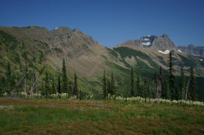
Before I started down the Loop Trail, I took a final look around. Looking back, I could clearly see the impossibly steep Garden Wall Trail that had used up so much of my time and energy.
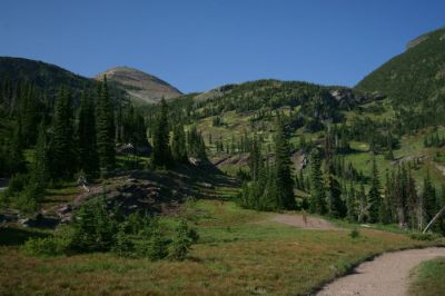
I could also see another potential destination — the fire tower atop Swiftcurrent Mountain. From up there, I would have an incredible view down into the Many Glacier area of the park. Earlier in the day, I had thought about hiking up there, before completing the hike. But now, it was too late. I’d have to tackle it some other time.
Loop Trail
To be clear, the Loop Trail is not a looping trail — it merely connects the Loop parking area on Going-to-the-Sun Road with Granite Park Chalet. It’s four miles long, with an elevation gain (or loss) of 2,200 feet. It’s definitely better to be going downhill than uphill on this trail, which is why it’s a popular option to park at the Loop, take a shuttle to Logan Pass, then hike the Highline-Loop combo. But keep in mind, 4 miles and 2,200 feet of elevation loss is nothing to take for granted, especially after you’ve already hiked 8+ miles.
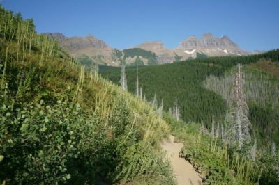
Adding to the misery of the Loop trail is the lack of anything interesting to look at. For a while after leaving the chalet, you’ll be hiking through a forest, but then you reach a wildfire-scorched clearing, which continues for most of the rest of the hike. Yes, there are spots with nice views, but they are nothing in comparison to what you saw earlier in the day, and most photo opportunities are spoiled by dead trees.
Oh, and with no tree cover, it’s sunny and hot. And that’s why I should have bought that expensive bottle of water at the Chalet. I kept an eye on my GPS device, and carefully estimated the remaining distance, then only allowed myself a sip of water every 1/2 mile.
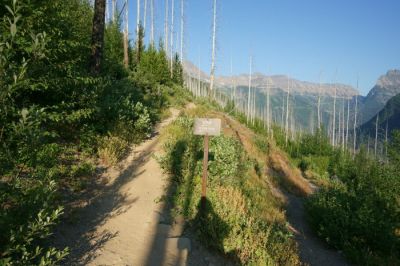
I was down to the final swish of liquid in my jug when I reached this sign — a critical point on the Loop Trail. The sign informs you that the route to the Loop trailhead is on the left, slightly uphill, instead of continuing downhill as you’d probably expect. Without that sign, who knows where I would have ended up.
Not far beyond this spot, I took my final drink of water, then trudged on. I finished the Loop Trail in just a little over two hours — well before sunset, but far too late to be on a trail like this, all alone. I didn’t see a single person after leaving the Chalet. Thankfully, I also didn’t see a single bear. I made a lot of noise as I walked, to scare them away, which might have helped.
Officially, I hiked 7.6 miles from Logan Pass to Granite Park Chalet, plus a 1.2 mile side-trip to Glacier Overlook, plus 4 miles from the Chalet to the Loop. That should be a total of 12.8 miles. However, my GPS reported a total distance of exactly 15 miles. I don’t know which is more accurate, but if anyone asks, I’m going to say I hiked 15 miles. Also, my Fitbit reports 33,781 steps, 18 miles, and 198 floors climbed. That’s a pretty full day.
Drivelapse Video
Here’s a look at the drive up and over Logan Pass, on Going-to-the-Sun Road:
… and the rear-view version:
The Bottom Line
Hiking the famous Highline-Loop Trail needs to be at the top of your to-do list in Glacier National Park. If you can, plan on spending the entire day on this trail — but if you can’t, just a partial in-and-out hike will be more than satisfying. Carefully watch the time, and remember that the Loop portion of the trail is more challenging than it looks. Bring plenty of water — a full gallon per person or more, if you can carry it. Of course, bring plenty of sunscreen as well as an extra layer of clothing, in case the weather changes.



No comments