A trip to Key West begins where the road ends. Of course, the road doesn’t actually end here, it’s just the end point of US Highway 1, in front of the Monroe County Courthouse. US 1 arrives in downtown Key West along Truman Avenue, then turns northwest on Whitehead Street for just a few blocks, before reaching its famous Mile 0 at the corner of Fleming and Whitehead.
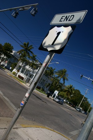
So, this begs the question, where is the Mile 0 sign? It should be attached to the signpost, but during my visit, it was missing. I imagine it’s a hot commodity for sign thieves. The “End” sign above the “1” must be popular, too. From pictures I’ve seen elsewhere, it changed recently. If something is missing when you visit, don’t forget to walk across the street and look for the “Begin US 1” sign, and maybe you’ll luck out and find a “Mile 0” sign there, too.
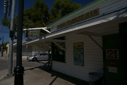
One of the more famous bars in Key West is the Green Parrot, which prides itself…
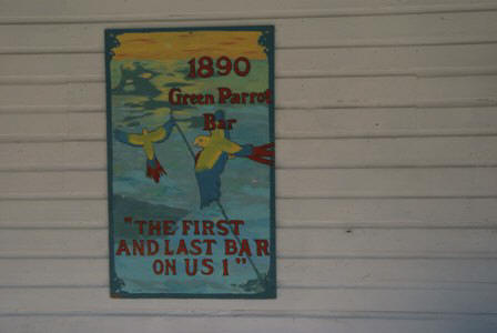
… on its location, as the first and last bar on US 1.
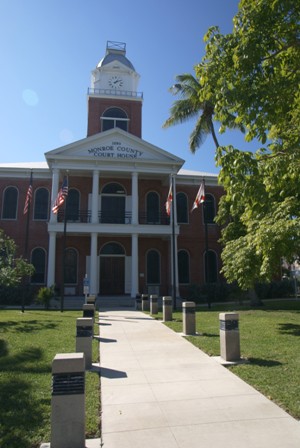
Across the street, check out the Monroe County Courthouse, built in 1890.
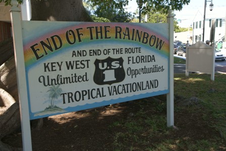
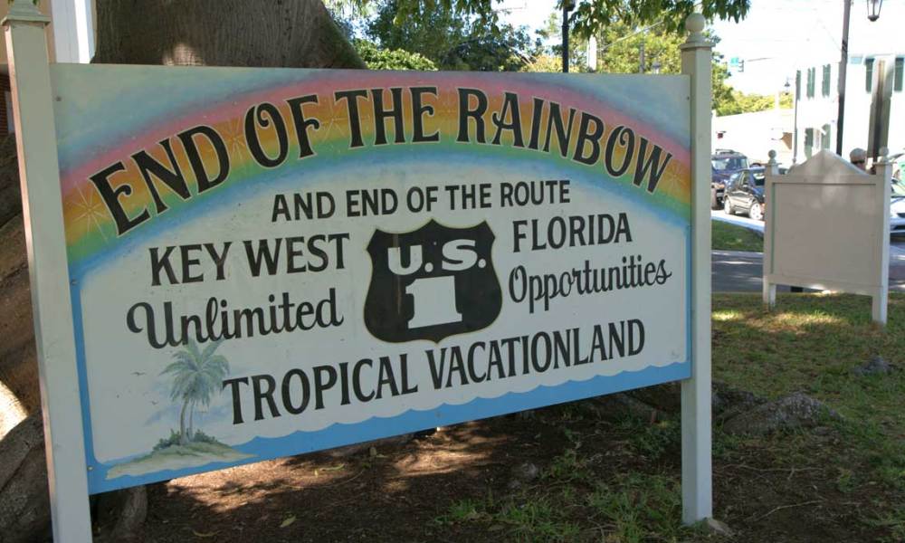
Another endpoint sign, of sorts, announces you’ve reached the end of the rainbow. That sign is located…
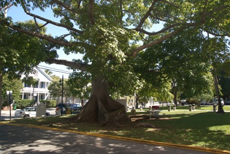
… underneath an impressive kapok tree. Kapoks are huge trees, mostly found in the rainforests of South America. Those above ground “roots” help stabilize the trunk. A sign next to the tree provides more fun facts (such as a possible explanation why ancient Mayans may believed the tree provided access to heaven), but it doesn’t shed any light on this particular tree.
On this trip, I was fortunate enough to have my bicycle with me. The streets of Key West are narrow and often crowded with cars. You’ll quickly want to give up on driving and parking, which is probably why mopeds and other low-powered scooters are popular on the island. You can rent one at shops all around town.
Whether you end up on a bike, a scooter, or you’re on foot, you’ll probably want to spend a lot of time wandering aimlessly. I’ll admit, that was my plan. I didn’t even have a map of the attractions in Key West — I thought, it’s a small island, how could I possibly miss anything?
One thing I did miss is the Key West Lighthouse. It’s a few blocks south of the “End 1” sign, on the corner where US 1 makes its final right-hand turn. I had chosen to turn up Duval Street, one block earlier, and in doing so I missed the lighthouse. I knew it was somewhere on the island, but I was expecting it to be at the beach — not in the middle of town.
It did make sense for me to focus my attention on Duval Street. This is the main drag — the core of Key West’s old town business district.
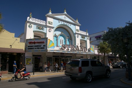
Who’d have guessed, mega-pharmacy Walgreens would step in and preserve the impressive Strand Theater on Duval Street. Inside you’ll find souvenirs and the typical drug-store selection, but the facade remains impressive.
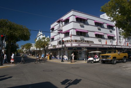
Just down from the Strand, the Pegasus Hotel, the only art-deco hotel in downtown Key West. A room here will set you back at least $150.
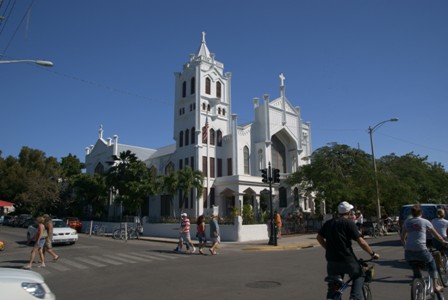
You can’t miss St. Paul’s Episcopal Church at Duval and Eaton Streets. After previous structures were wiped out by hurricanes (in 1846 and 1909) and the Great Fire of Key West (in 1886), the current concrete structure opened for worship in 1919. It’s open daily for anyone who wants to stop in and pray.
Heading South…
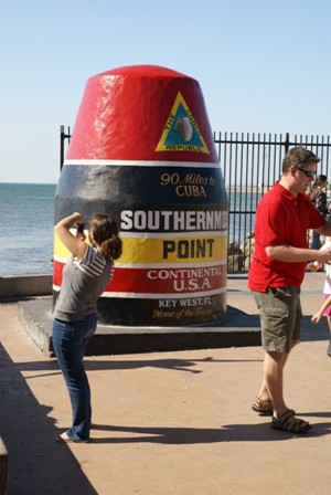
Before you get too excited about standing at the Southernmost Point in the Continental United States, you should know that it’s not really the southernmost point. It’s pretty obvious, as you stand in front of the famous concrete buoy and pose for your picture, that the buoy tells lies. There is clearly land right next to the landmark that’s further south than the buoy. Adding to the deception, there are other islands in the Florida Keys that are further south than Key West, and the true Southernmost Point is on privately owned Ballast Key, nine miles west (and slightly south) of the lying hunk of concrete. And if all that’s not enough: the “90 miles” claim is also inaccurate. The nearest Cuban real estate is 94 statute, or 81 nautical miles south.†
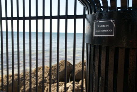
Ugh! Even the trash can tells lies!
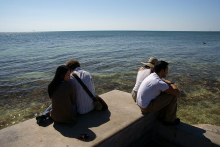
Seriously, though, it’s remarkable to stare south, and realize there’s nothing out there but a whole lot of water, some sharks, and then communism.
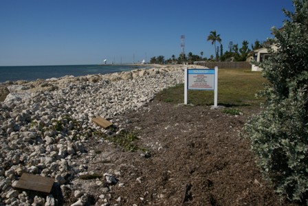
One of the more southerly points visible from the southernmost point lies within the NASKW — the Naval Air Station Key West. A fence keeps you from going any further south.
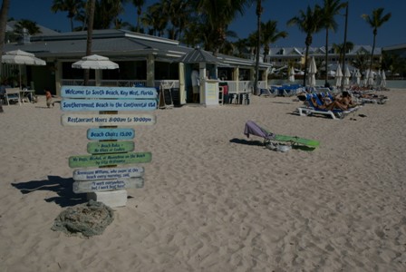
A block away, the southernmost madness continues, with the Southernmost Beach, appropriately named South Beach. It’s famous for being the location of Tennessee Williams’ daily swim.
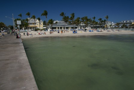
Just a little south of the Southernmost Beach, Emma Carrero Cates Pier takes you just a short distance out into the Atlantic Ocean.
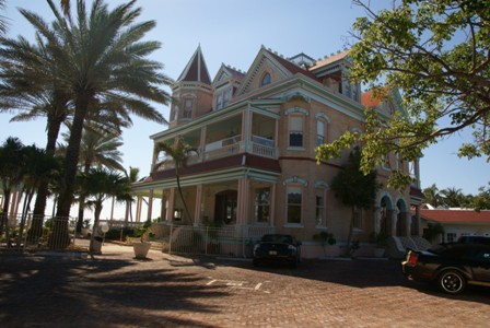
Next to the pier and the beach, scope out the ornate Southernmost House, Casa Cayo Hueso, The Harris Family, including Judge Jeptha Vining Harris, owned the home from 1900 until 1939, when the Ramos-Lopez family purchased it. They’ve owned it ever since. There’s a museum on the first floor, and a bed and breakfast upstairs.
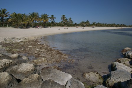
If you’re looking for a big, sandy beach with plenty of room for plenty of people, stop at Smathers Beach along A1A (Roosevelt Boulevard). A1A circles around the southeastern side of Key West, also passing by the airport. Access is easy here — just park at a meter on the side of the road, and walk onto the sand.
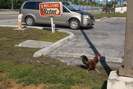
I wasn’t planning on sticking around for sunset (a perfectly good one awaited me at Bahia Honda State Park, up the road a few miles). I also didn’t want to spend a whole lot of money at one of the nice cafe’s along Duval Street (it’s not as much fun when you’re traveling solo). So I ended up at the KFC on US 1, in the not-so-quaint part of Key West. Much to my surprise, there were reminders of where my sandwich came from, all around the parking lot!


No comments