For less than 24 hours, successfully climbing to the top of Angels Landing was my proudest accomplishment of the trip. But even on the hike down, I began to plan the next day’s hike. Five miles round trip wasn’t bad, I thought. I could probably walk further and climb higher. I had devoted a full three days of my trip to hiking in Zion, so why not tackle one of the longest, toughest day hikes in the park?
Brimming with confidence on Day 3 of this trip, my second day in Zion, I stepped off the park shuttle at Weeping Rock, and began the 8 mile (round trip) hike up to Observation Point.
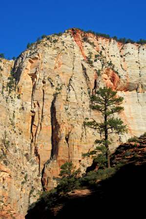
That’s it up there. Observation Point is at the very top of that very high mountain, right where that red stain begins.
The trail wastes no time gaining elevation. From the Weeping Rock trailhead, the East Rim/Hidden Canyon/Observation Point trail begins its climb, navigating around a series of switchbacks along a path that’s often cut directly into the side of the mountain.
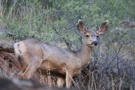
I had started early, and it was still shady as I accomplished the first stage of the trail. It was also silent. There were only a couple of other hikers on the trail, and they turned off at the Hidden Canyon side trail. After that, it was just me, a few lizards, and to my surprise, a deer on the ledge above me, quietly munching on breakfast.
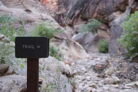
After a tiring climb up from the canyon floor, the Observation Point trail turned inward. Here, it enters Echo Canyon, traveling for a moment at the bottom of a dry wash.
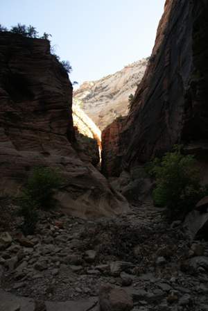
Thankfully, this part is flat. Unfortunately, you don’t have long to rest…
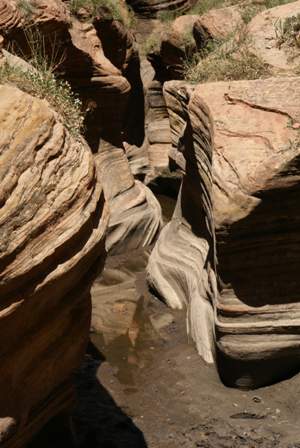
… because Echo Canyon quickly narrows…
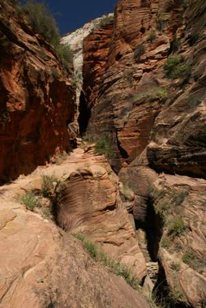
… and the trail once again climbs. You can’t go very far into the slot canyon without wading into some stagnant, mucky water. Instead, follow the path up and through the slot. On the way back, you’ll be ecstatic to arrive here, on account of the shade provided by the canyon walls.
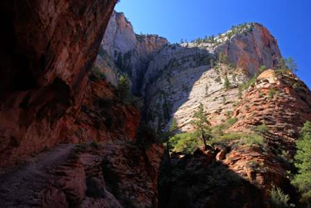
As you emerge from the slot, you suddenly realize you’re in a completely different place. Echo Canyon widens out dramatically, and you realize that Observation Point isn’t the only great thing about this trail–the views are spectacular the entire way.
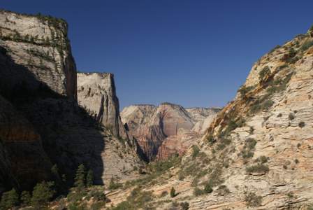
Now it’s once again time to start gaining some elevation. It was about at this point that I started lying to myself. I decided I must only be about a half mile from the top, because after all, I had already been walking for a very long time. I looked back into the main canyon in the distance, and decided that I must be about as high as the top of Angels Landing (a total lie), so therefore the top of Observation Point couldn’t be far. My pedometer must have stopped working, I had taken far more steps than it said.
It was also at this point that suddenly, I realized I was taking a direct beating from some intensely powerful rays of sunlight. Up until now, I had been in the protective shade of either the main canyon, or Echo Canyon. But now, I was fully exposed to the sun. There were hardly any trees to provide relief. I had only sipped on my water supply a time or two, now, I was hitting it every few minutes.
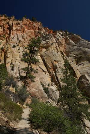
The trail continued. I knew where it was going. Up there. All the way to the top. It became more difficult to lie to myself.
For the first time, I came upon some other hikers. It was an older couple, not elderly, but certainly not young. They’ll never make it, I thought. Heck, I was barely making it, and half the climb still laid before me. I said hello and tried to strike up a conversation, but it became pretty clear that they didn’t speak much English. Just my luck, the only other people on this trail today, and I couldn’t even joke with them about the unrelenting heat or the ridiculously steep slope. For a few minutes, we did that thing where we walked not far from each other, trying to figure out who should be ahead. I eventually passed, then realized if I stopped for a breather, we’d face another moment of awkwardness. So I hit the gas, hoping to create a gap. They’ll turn around soon, I thought.
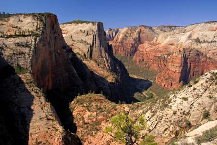
From then on, it was switchback after switchback, so many it should have been illegal. As I climbed higher, the views got better. Suddenly I could once again see all the way back into the main canyon. In fact, I could see the entire path:
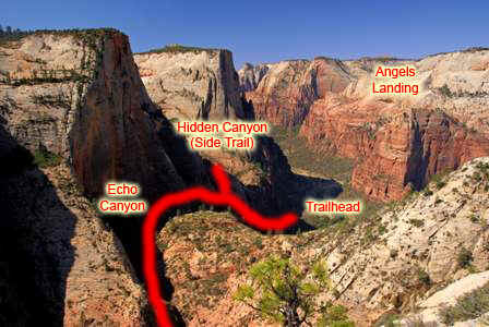
Finally I didn’t have to lie to myself. I was higher than the top of Angels Landing, which meant I had gained at least 1,400 feet. That was good news, but the most challenging two switchbacks were still ahead.
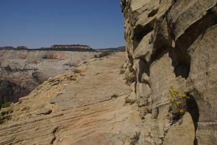
If you know what to look for, from almost anywhere in Zion Canyon you can see the final two switchbacks of the Observation Point Trail. They’re carved directly into the mountainside, leaving hikers with a stone shelf to walk on, that’s no more than six feet wide (if even that).
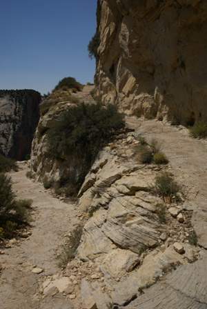
At long last, you make the final turn… and travel up the last, long stretch. You’ll know you’re almost there when the rock turns from grey to red.
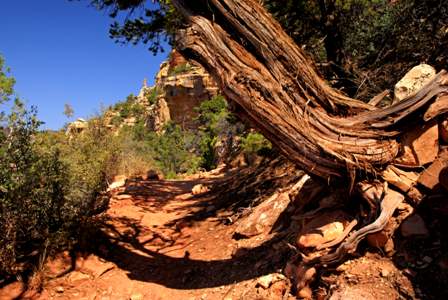
Finally, you’re there! No, not at Observation Point–you won’t even care about that at this point. You’re simply at the top of the mountain, and a level trail is your reward. Observation point is still about a mile away, but at long last you’re not struggling to put one foot in front of the other.
The top of the east rim is a funny place, that feels like several different worlds. In some spots, there are trees big enough to provide some shade…
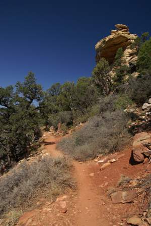
… and towering rock columns at the side of the trail. Walk a bit further…
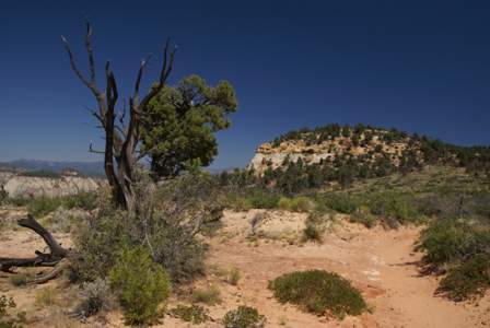
… and you’ve stumbled into the middle of a barren high-country desert…
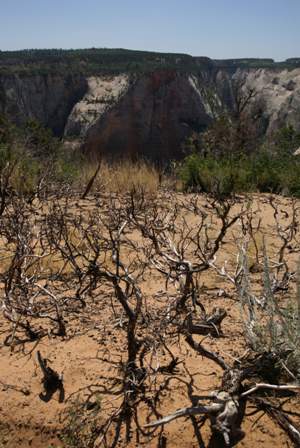
… or the middle of a forest of tiny, contorted trees that look like they recently fell victim to a miniature forest fire.
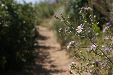
Then suddenly, the trail is lush again, with low growth on either side, and wildflowers springing up along the sides of the path.
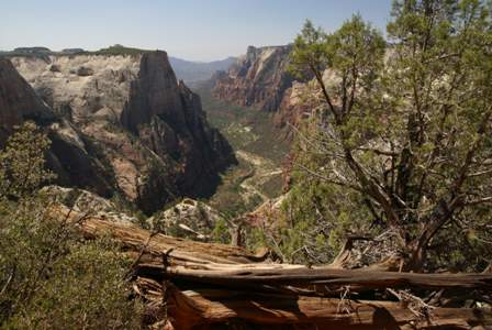
There are a few spots where an incredible view opens up on your left-hand side, giving you a preview of what to expect at Observation Point.
With about a half-mile to go, the Observation Point Trail splits off to the left. Now you’re on the final stretch–less than a thousand steps to go.
There are almost no good views during this final half-mile, until…
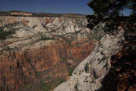
… this scene opens up along the right side of the trail. Keep going, just a few steps further…
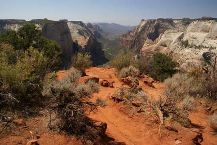
… and the end of the trail, Observation Point, comes into view.
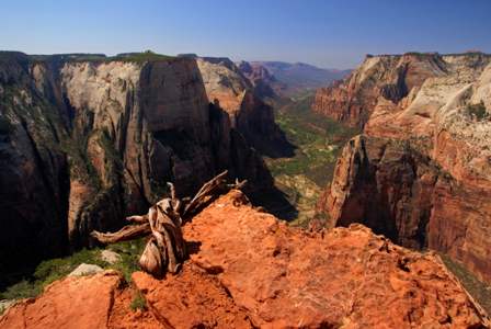
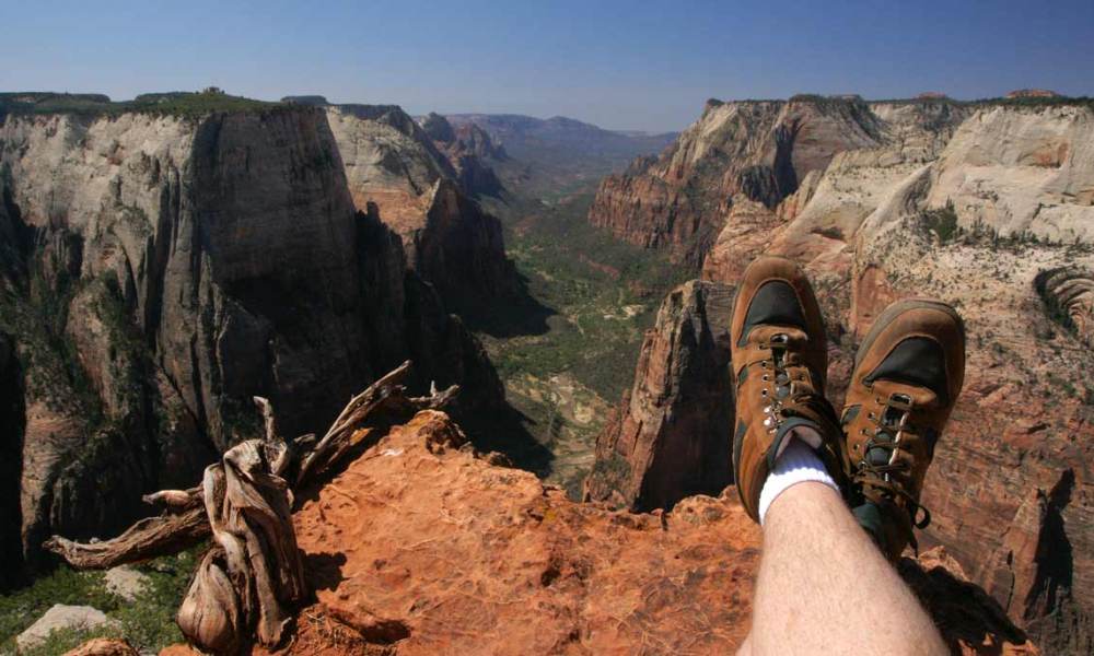
No surprise, I was the only one here. This of course meant that I had my pick of places to sit and enjoy the view. Even though there was no shade, I headed straight for the very tip of Observation Point, kicked back…
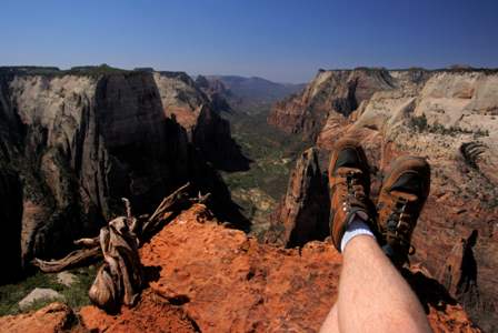
… and enjoyed what’s arguably the best view in Zion National Park, looking south into the lower canyon.
I sat here alone for a few minutes in the perfect quiet, soaking it all in. Then, voices approached from behind. Darnit! I wanted this all to myself. I turned, and to my amazement, it was the older couple I had passed on the way up, about two miles and at least an hour earlier. They had made it!
We exchanged waves and once again tried to communicate. Then, they settled into a spot with virtually the same view about 20 feet away. The only difference was, their spot was in the shade. Darnit! Why didn’t I think of that?
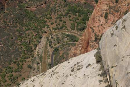
I eventually gave up my perch at the edge of the cliff, and wandered around, looking for pictures to take. Any way you look, the view is great. The picture above looks off the right side, straight down into the canyon. From the other side…
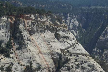
… you get a great view of those final, terrible switchbacks, cut directly into the mountainside. This is the part of the trail you can spot from almost anywhere.
I quickly discovered that my foreign friends had found the only spot at Observation Point that provided both a great view and some shade. So I settled for a spot with less scenery and more solar relief. I checked the water supply, and calculated how much I could safely gulp. My backpack had a 3-liter bladder, which was still about half full (and thanks to the ice machine at my motel, still somewhat cold, too). I had also filled a separate one-liter bottle, and now decided that it was safe to consume the entire thing. It wasn’t cold, and I didn’t care. I was very thirsty.
As I finished my ration of water, and a few of the snacks I had packed, a few more people arrived at the end of the trail. It was by no means crowded, but I realized there was no chance that I’d have the place to myself again. So I headed back down.
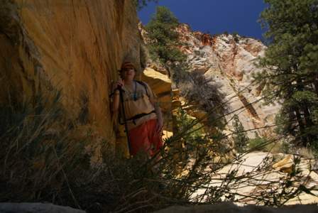
After at least a mile and a half of hiking, I found a very small patch of shade. Suddenly I decided a self-portrait was in order. I don’t know why–probably because it gave me an excuse to spend an extra minute or two away from the sun.
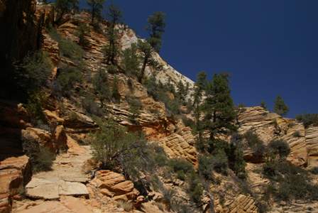
Checking my pedometer on the return trip, I determined that this is the trail’s halfway point. Note the triangular outcropping of rock in the middle of the picture. From here, I believe, it is two miles to the top, and two miles to the end. An easier landmark to spot, however, might be the point where the Observation Point Trail splits from the East Rim Trail. This point is also nearby.
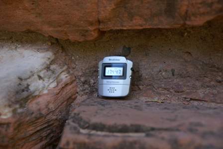
At long last, I was back at the trailhead. A small creek here flows from Weeping Rock, and I walked down to the bank, pulled off my hiking boots, and plunged my feet into the cold water. Ahhh, that was nice. I took a picture of the pedometer. The final count: 17,447 steps. That’s one heck of a hike–the longest single hike I’ve ever tackled.
For the rest of my time in Zion, I looked up at Observation Point in amazement. I’m still stunned that I made it there and back.
Note: This trip was first published in 2007.



No comments