Want to take a short walk through the woods, enjoy the sounds of rushing water, and add another waterfall to your “I-saw-it” list? Silver Falls provides a nice option, on Mount Rainier National Park’s southeastern side.
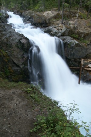
Silver Falls is a roughly 40-foot cascade, on the Ohanapecosh River (which parallels Washington Route 123, north of the Ohanapecosh campground). There are at least three ways to see this falls, the easiest of which involves a very short hike from an unnoticeable trailhead along the side of Route 123. The trail begins at a wide spot on the south side of the road, that’s big enough for several parked cars. You’ll find this wide spot just south of the turnoff to Stevens Canyon road.
Option 2 involves hiking north, and uphill, from the Ohanapecosh campground, while option 3 involves a southbound, and downhill hike from the Grove of the Patriarchs parking area, which is on Stevens Canyon Road, just inside the park entrance gate.
I didn’t know that the short route existed — I only knew of option 3, so that’s the route I hiked. It’s probably only about 1/2 mile, one way, from the Grove of the Patriarchs trailhead to the falls.
Leaving the parking area, you’ll probably be the only person who’s crossing the street and headed for this trail. It’s easy to find, but it isn’t prominently marked, and I’m willing to bet that most people who stop at the Grove of the Patriarchs don’t even know it’s there.
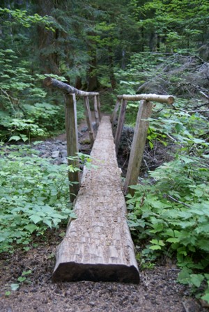
Starting down the trail, you will cross this log-bridge, and wander through the forest. It’s not long before you realize what the rest of the hike will look like: you’re going downhill, running parallel to Ohanapecosh River, but high enough above it that you can’t access the water.
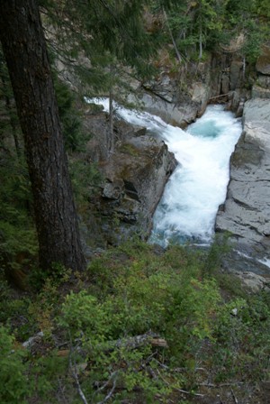
On your left, you’ll catch occasional glimpses of the river, as it spills through narrow chutes and over small cascades. Again, there’s no safe way to get any closer to the water, so you’ll need to be content with the view from the trail.
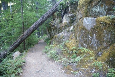
Downhill you go, all the while realizing that the trail will require an uphill climb, as you retrace your steps. Of course, you could cut across to the highway, and follow the road back to the trailhead. The slope would probably be a little easier.

There is no sign to announce that you’ve arrived at Silver Falls, but it’s fairly obvious that this is the biggest waterfall on this portion of the river. There are some fairly good, but not ideal, spots from which to view the falls.
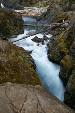
The best vantage point is downstream, just a bit, where a foot bridge crosses the river. From here, you have a limited view of Silver Falls (you can just barely see it in the upper right-hand corner of the photo above), but you will get a nice view of the chasm just below it, where the glacier-blue water funnels in between rocks, for a speedy journey under the bridge…
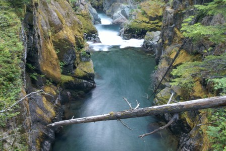
… and on downstream, where more mini-waterfalls await.
While this trail makes for a good late-day hike, I was here almost too late in the evening. I had to hurry back uphill to get to my car before it was too dark. If you took the shortest route to the falls (option #1, explained above), you wouldn’t have that problem. The trail that crosses the foot bridge leads you to the highway, which is probably only 2/10 of a mile away (or less).


No comments