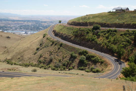
If you love to drive up the kind of road that usually ends up in car commercials, you’ll enjoy the Spiral Road above Lewiston, Idaho. For 60 years, this twisty road was the way to get out of Lewiston, headed north. Now that you don’t have to drive it, you’ll want to, just for the fun.
My Visit
Even though I started in Lewiston and drove uphill, let’s start at the top of the hill and head down into town.
The top of Lewiston Hill is marked by several signs — one of which proclaims the altitude as 2,756 feet. That’s about 1,800 feet higher than the rivers below. Take time to read the signs, and you’ll learn how the Lewiston Grade was an engineering marvel upon its construction in 1917. You’ll also find out that Lewiston served as a steamboat landing that supported the gold rush, starting in the 1860’s. It became a seaport in 1975, when locks and dams tamed the Columbia and Snake rivers.
Of course, the most marvelous thing at this spot is the view. From here, you’ll be able to see all of Lewiston, Clarkston, the Snake and Clearwater Rivers, and of course, the serpentine road that twists around 64 curves to make it to the top of the hill.
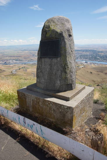
A stone pillar also memorializes C. C. Van Arsdol, the engineer responsible for the road, along with several other highways and railways.
Near these turnouts at the top of the hill, there’s also an old gift shop/restaurant. I was sad to see it was closed, presumably some time ago, because I would certainly have purchased some sort of souvenir from the Spiral Road.
Headed downhill…
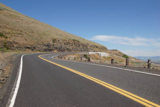
… there are numerous places to stop and photograph the road.
Or, you can just stop in the middle of the road for a picture. Any oncoming traffic will be moving pretty slowly, making it reasonably safe (with caution). I saw very little traffic during my drive up the hill.
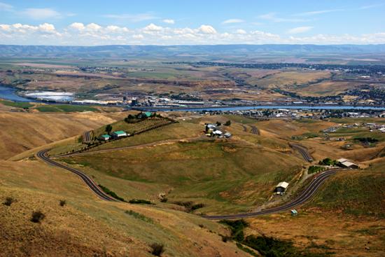
The road provides one great view after another. You’ll also get pretty close to the giant L on the hill above the town. I don’t know if there’s a way to hike over to the L, but if there is, it will be on the first big curve after the viewpoints, headed downhill.
Once you get down to the bottom, it only makes sense to check out the town.
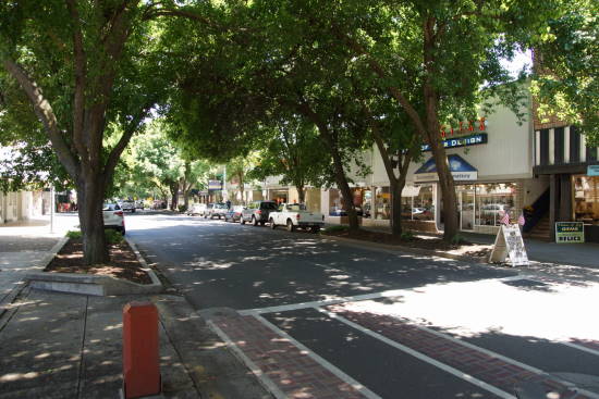
Lewiston has a surprisingly shady Main Street, heavily lined with mature trees. I’m sure it would be quite pretty here in the fall.
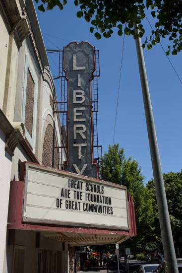
The Liberty Theater on Main Street has a great old sign. It opened in 1921 and closed in 2005, according to Cinematreasures.org.
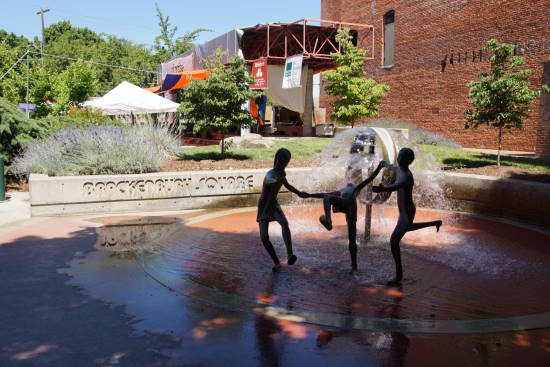
Brackenbury Square offers a splash-friendly fountain, in the shade of those big trees.
And don’t forget, downtown Clarkston, Washington is just across the Snake River.
The Bottom Line
Downtown Lewiston offers a nice place to stop and stretch your legs, but I think the Spiral Road is the main attraction in town. Even if you don’t drive the road, I’d suggest detouring off US 95 to enjoy the viewpoints at the top of the hill.
Location
 Lewiston, Idaho is located at the confluence of the Snake and Clearwater Rivers, along the Idaho/Washington border. Its sister city is Clarkston, Washington, directly across the Snake River.
To find downtown Lewiston, simply follow US 12 into town and look for Main Street (rather than following the bypass on Highway 12).
You’ll locate the top end of Spiral Drive along US 95, north of Lewiston. To find the bottom end, turn off US 95 at Down River Road (Idaho 128), then turn on the only road that looks like it’s going to go uphill.
Drivelapse Video
Check out this time-lapse, dash-cam video of the drive up the Spiral Road above Lewiston:

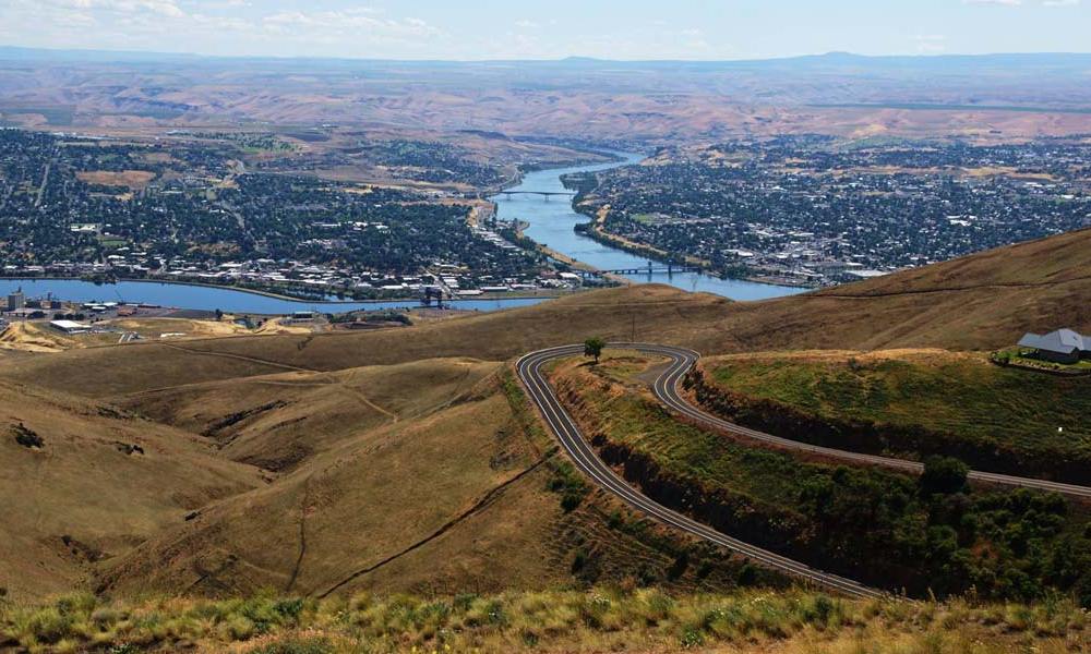
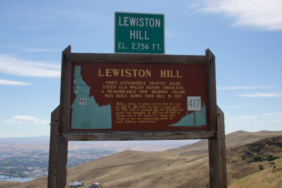
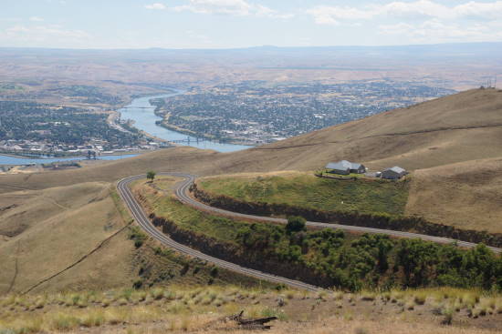
The road winds up Lewiston Hill, providing an exceptional view of the town below. The breathtaking scenery makes the drive worth the endless twists and turns.