It may be the best kept secret on old US 66: a side road that takes you to the bottom of the Grand Canyon. Such a route would never be allowed on U.S. land, but the territory between Peach Springs and the Colorado River is is part of the Hualapai Indian Reservation.
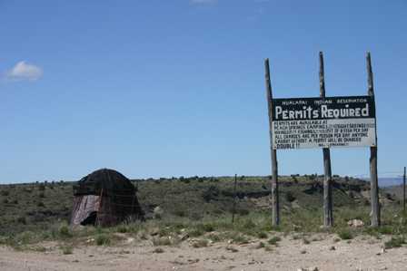
The Native Americans in this area know that Diamond Creek Road is unique, and they’re not afraid to charge a premium for the right to drive it. Not long ago, it only cost around $6 for a one-day sightseeing pass. The price has nearly tripled since then: I paid $16.05. (A tip I received in 2011 puts the price at $26.50 per person!) You can purchase your permit at the nice, AAA approved Hualapai Lodge in Peach Springs.
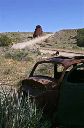
From Old 66, Diamond Creek Road takes you through Peach Springs’ residential area, which unfortunately consists mostly of small, poorly maintained housing for members of the tribe. On the outskirts of town the road begins its descent, passing a rusty old silo and the shell of an old car.
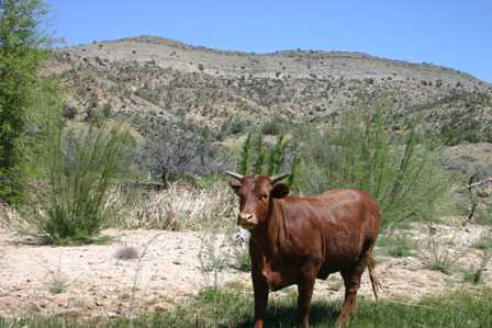
While you’re not sharing the road with many other people, you will be sharing it with some livestock, so keep an eye out.
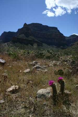
After you’ve left the houses and cows behind, the road continues on a mostly flat, slow descent for at least 10 miles. Once you’ve dropped perhaps 1,500 feet in altitude, you start to feel as if you really are entering a canyon.
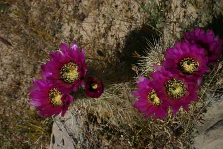
During my visit in April, 2005, life was flourishing in the canyon. Cactus and other desert plants were blooming everywhere. Various critters were also scampering about, so I had to keep a close eye on the ground whenever I stepped out of the car.
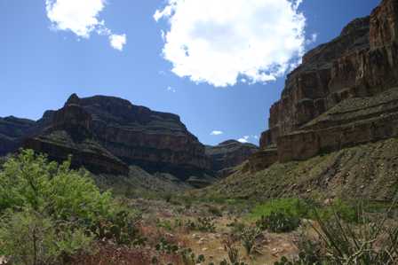
This dramatic side canyon was one of the first picture-worthy stops I came across during my descent.
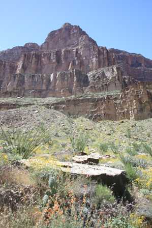
Once you’ve passed the halfway point, there seems to be a new scenic view every time you round a curve.
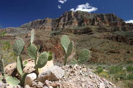
Here’s another great view of the steep canyon walls, just off to the side of the road.
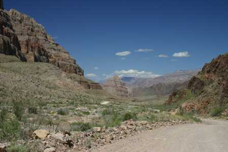
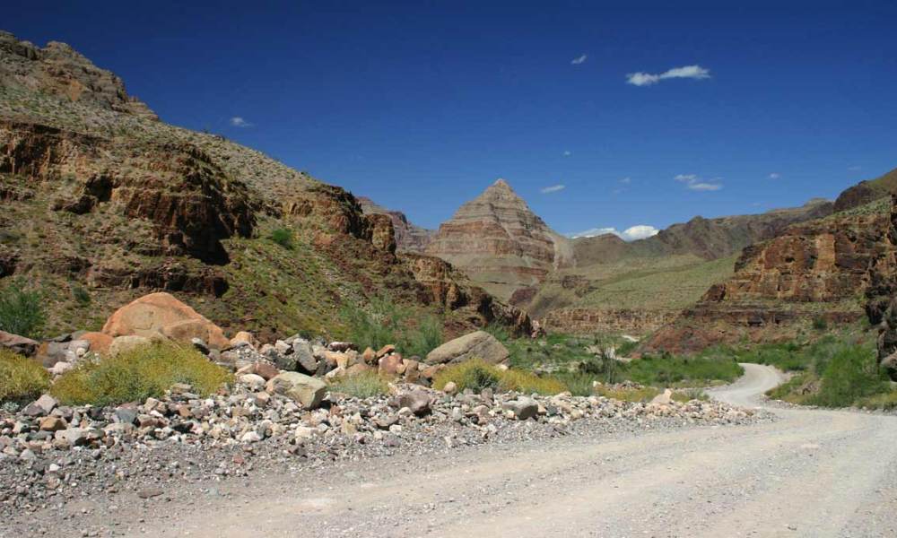
You know you’re getting closer to the end of the road when Diamond Peak makes its appearance in the distance.
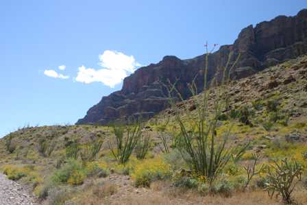
It’s amazing that an area which seems so desolate and dry could spring forth with so much life. The thin spires on these tall plants sprouted at least 10 feet high.
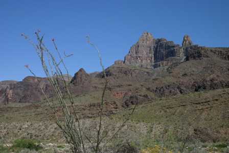
Look to the left or right almost anywhere, and you’re reminded that you’re in an amazing place.
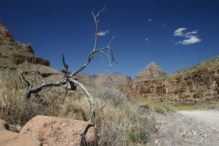
Drawing ever closer to Diamond Peak…
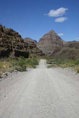
Sure, the road looks good here, but it’s about to get a lot worse!
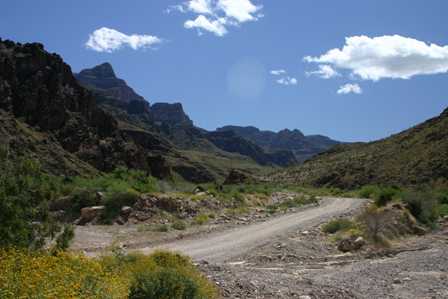
After traveling about 19 miles, you finally reach some sign that tourists have been here before. A gravel parking lot provides a place to pull off the road. There’s a small, sheltered picnic area and bathroom facilities here. The only problem is, the picnic tables have no seats, and the “facilities” consist of a two-stall outhouse with no doors, and certainly no cleaning supplies.
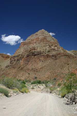
But you didn’t come all this way to sit at a picnic table or whiz in privacy. You came here to see sights like this one. Diamond Peak is right in front of you. It’s an incredible sight.
At this point, you’re only about 2 miles from the mighty Colorado River. Only 2 miles from the end of the road. Only 2 miles from being able to say, “I drove to the very bottom of the Grand Canyon!”. There’s only one thing standing in your way:
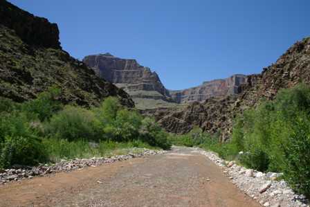
As soon as you leave the picnic area, Diamond Creek Road and Diamond Creek combine, to become one and the same. The brisk, cool stream of water runs on top of the road’s surface. This came as quite a surprise to me, for a couple of reasons. One, I had read somewhere that vehicles had to “cross” the creek once or twice near the end of the road, not “drive through it”, and two, the folks who sold me the $16.05 pass never mentioned it either.
So at this point, I had a choice. I could turn around, I could leave my car and hike the rest of the way, or I could try my luck at driving through the water. I ruled out the first option immediately: I had come too far to quit now. And as for hiking? I had hiked enough over the past ten days. So in a moment of adventurous and foolish thought, I decided to try my luck and test my rental-car-abusing skills. “The water isn’t very deep”, I rationalized, “and maybe the road will be dry again after I round the next curve.” So I went for it.
I hit the water running, driving fast enough to not get stuck, but slow enough as to navigate my way around the jagged rocks and shock-blowing bumps. After all, the road was still rough, even though it was now underwater. I kept going, without hesitation, until I made it to that curve.
It was there I discovered that when the road curved, the creek curved. There was no dry road for as far as I could see, possibly for the next two miles. And that meant there was no sane reason for continuing to splash my way down to the bottom of the Grand Canyon.
I stopped the car on a dry “island” in the middle of the road, and stepped out. The water was running fast on both sides. I had about 20 feet of dry dirt to navigate a 3-point turn, which ended up being more like a 7 point turn. That’s about when I realized what I had done, and the situation I had put myself in. From this point, my only choice was to drive uphill and upstream.
Rental cars don’t come much crappier than the one I had driven for the past ten days. The radio didn’t work. The wheels were out of alignment. The whole car vibrated when I hit 65 miles per hour. I had added more than 2,000 miles to the odometer in only a week and a half. And now, the dirty, gold colored Chevy Classic I had cursed and kicked was the only thing keeping me from being stranded in the middle of a creek, in the depths of the Grand Canyon.
I thought about my chances, the slope of the road, the speed of the water, the nearest tow truck which was probably at least 19 miles away, the cell phone on my passenger’s seat that was out of range, and my flight back to Tampa, which left in less than eight hours. Then I think I said a quick prayer… and hit the gas.
This would probably be a much better story if my Classic had sunk into the gravel, if I had missed my flight, or if a Hualapai Indian spirit had appeared before me and rescued me. But none of those things happened. I kept up my speed, sloshed my way back to dry land, then counted my blessings for the next 19 bumpy miles back to town.
I guess it’s a pretty boring end to the story. Maybe next time I tell it, that Hualapai spirit will make an appearance.
After returning to Peach Springs, continue to head west toward Kingman, AZ. From there, you can take US 93 north across the Hoover Dam and into Las Vegas.
Note: This trip was first published in 2005.



No comments