If you want to take in the best view of Salt Lake City, you’ll have to be willing to do a little climbing — and maybe get a little muddy. Ensign Peak is the rounded hill with the small monument on top, located directly above the state capitol building. It’s impossible not to notice it, if you’re like me, and always looking for good places to take a picture.
I noticed the hill as I was driving around Salt Lake City, looking for something to do on a rainy June afternoon. I would have spent the day hiking in the mountains, but there was still too much snow. I was considering a hike up City Creek Canyon, but couldn’t find it (though I did locate it, and Memory Park, later — more on that in a moment). The truth was, I wasn’t enthusiastic about any of my options, because of that gloomy weather — but I was determined not to waste the rest of the day. So, when I spotted Ensigh Peak, I went in search of a possible path to the top.
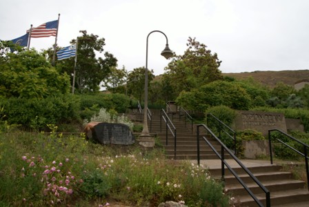
After some aimless driving through some of Salt Lake City’s nicest neighborhoods, I found the path. It starts here, on Ensign Vista Drive.
Don’t let the stairs fool you. Only this neatly-maintained park at the foot of the trail is covered in concrete. Almost all of the trail is dirt. And when I say dirt…
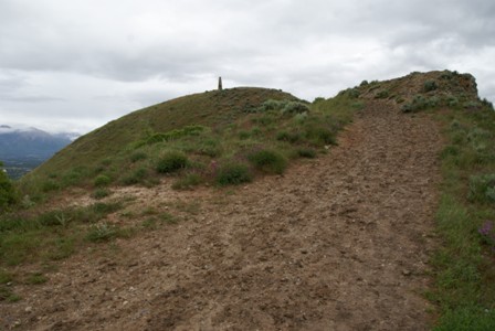
… I mean mud. Mud like I’ve never hiked through before. Mud so thick, it reminded me of the time I tried to walk through a freshly-plowed field, and nearly had the shoes sucked off of me. Mud so slippery, every step forward came with a half-step slide back down the hill. Mud so sticky…
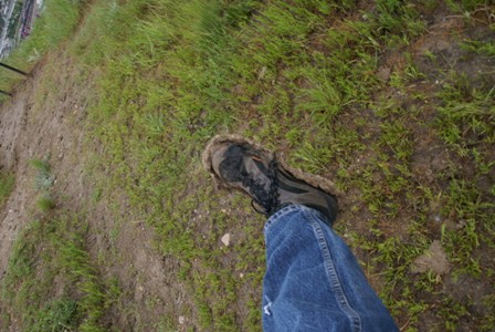
… my shoes suddenly doubled, then tripled in weight. The mud caked on, and squished over the sides of my soles, then climbed halfway up to my ankles. I tried to walk on the edges of the path, where a few blades of grass tried to hold the dirt together, but it was of no use. There was no other option, but to keep trudging uphill, and use every rock along the way as a surface for scraping off the excess muck.
Of course, this is all because of all the rain the area had received, on this positively miserable day. But as I plied through the mud, I came to a realization: it wasn’t raining anymore. In fact, the clouds were breaking up, just a little bit. Maybe the day could be salvaged after all. Perhaps the sun would come out, just as I reached one of Salt Lake City’s most beautiful viewpoints.
And that’s exactly what happened.
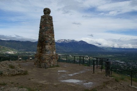
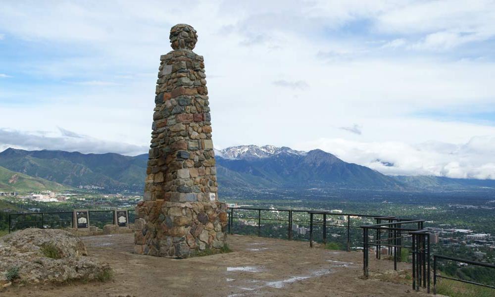
From the street, Ensign Peak’s peak is quite obvious, thanks to this stone monolith, located in the middle of a slightly less muddy viewing platform. All the railings had been used by previous visitors as boot scrapers, so I had to carefully select a place to lean…
Click image for a larger view.
… and enjoy a fantastic panorama of everything that is Salt Lake City: the Capitol, downtown, the Wasatch Mountains…
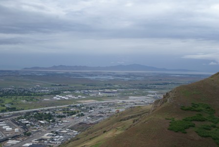
… and to the west, the Great Salt Lake itself, surrounding Antelope Island.
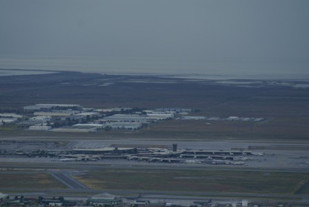
The SLC airport is over there too, on the edge of the lake. After watching for just a few minutes I spotted jets taking off and landing. It was an especially remarkable experience, because I don’t think I’ve ever looked down on a plane taking off before.
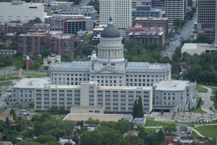
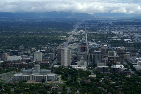
Of course, the most prominent piece of scenery from Ensign Peak is the Utah Capitol Building, perched on its own hill overlooking…
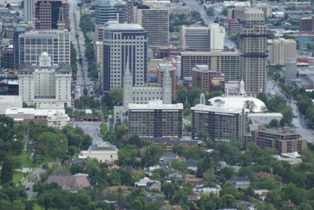
… downtown Salt Lake City. There, in the middle of this picture, you can see the spires of the famous Mormon Temple, which looks a little bit diminutive from up here.
July 26, 1847, two days after the Mormon pioneers entered this valley, Brigham Young and party climbed to this point, and with the aid of field glasses made a careful survey of the mountains, canyons, and streams. In the group were Heber Kimball, Wilford Woodruff, George Smith, Ezra Benson, Willard Richards, Albert Carrington, and William Clayton. Woodruff, first to ascend to the peak, suggested it as a fitting place to “set up an ensign” (Isaiah 11:12). It was then named Ensign Peak. Subsequently the Stars and Stripes were raised here.
After seeing the valley from Ensign Peak, Brigham Young famously declared “This is the place”… the place he had seen in a vision which included Joseph Smith (the founder of the LDS church). From the peak, the early town leaders laid out plans for Salt Lake City. Ensign Peak also became a place to gather for meditation and religious ceremonies.
The monument at the top of the hill is 18.47 feet tall, and was designed by Brigham Young’s grandson, George Cannon Young.
If you’re slightly dissatisfied with the lack of symmetry in the view at Ensign Peak, and would prefer to see the state capitol building perfectly lined up with State Street…
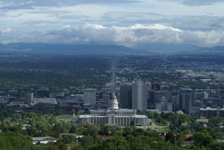
… be sure to stop by the Ensign Peak Amphitheatre. It’s mostly overgrown and somewhat graffiti-scarred, but this spot about halfway down the trail has a perfectly aligned view of the capitol.
Drivelapse Video
Here’s the time-lapse, dash-cam video of my drive into Salt Lake City (from my hotel near the airport), up to Ensign Peak, then around town:


No comments